CASRI

CASRI

CENTRAL APPALACHIAN SPRUCE RESTORATION INITIATIVE

  • Home
  • About
    • Who We Are
    • History of Red Spruce
    • Why Red Spruce is Important
    • Partners
  • What We Do
    • News
    • Research
      • Climate Change
      • Mapping & Modeling
      • Red spruce ecosystem
      • Restoration
    • Reports
      • Annual Reports
      • Meeting Minutes
  • Get Involved
    • Events
      • Volunteer Planting Days
      • Partner Events
      • Conferences & Meetings
    • Share With Us
  • Donate
  • CASRI Member Login
    • Native Plant Propagation Sub-Committee
    • Outreach & Education Sub-Committee
    • Research & Active Management Sub-Committee
    • Strategy Sub-Committee
Mapping & Modeling Research 

Spruce Mapping Project Complete!

July 3, 2013April 10, 2019 Dave Saville

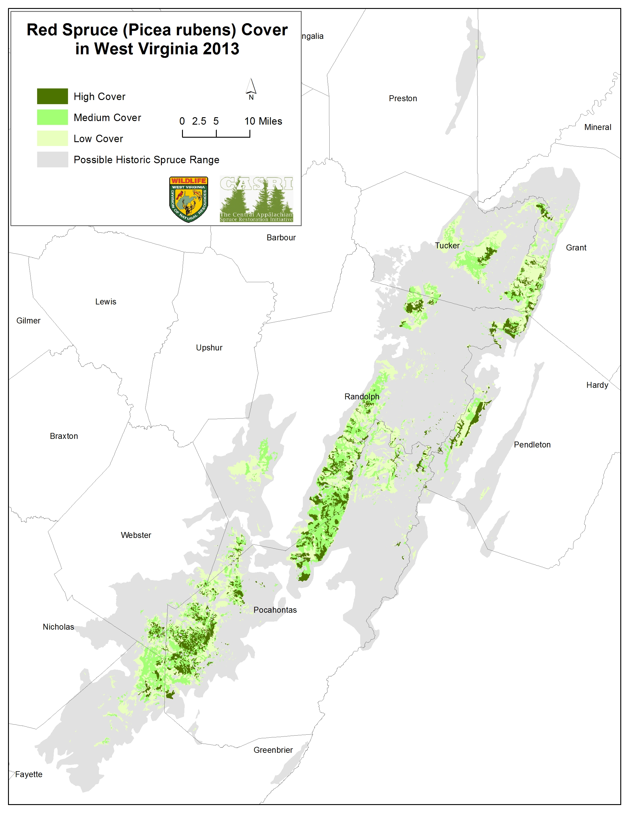
After almost 3 years and a lot of work, CASRI partners have finally completed a current map of red spruce cover across WV! The red spruce cover map is intended to assist with restoration of red spruce communities and the high elevation species that depend upon them.

View the map.
Download the data for free from the WVGIS Center.

  • ← Site characteristics of red spruce witness tree locations in the uplands of West Virginia, USA
  • Friday, August 2, 2013 – Native Seed Collection Workshop for Restoration and Conservation →

WHO WE ARE

This website has been established and is being managed by the West Virginia Highlands Conservancy to support the work of the Central Appalachian Spruce Restoration Initiative (CASRI).

CASRI is a partnership of diverse interests with a common goal of restoring historic red spruce-northern hardwood ecosystems across the high elevation landscapes of Central Appalachia.

Contact Us

For more information and volunteer opportunities, please contact:

CASRI Admin
CASRI.RS@gmail.com

Copyright © 2022 CASRI. All rights reserved.
Theme: ColorMag by ThemeGrill. Powered by WordPress.